A very important function of the Garrett Soil Conservation District has been to protect the county from destruction of our natural resources due to flooding.
Prior to the 1960’s, downtown Oakland flooded several times a year. And it wasn’t just a few inches, as you will see from some of the photos below. We are talking about streets being under water and downtown stores being flooded! Imagine the amount of clean-up that had to happen regularly to remove the dirt and debris and avoid the outbreak of diseases! It was extensive. Not to mention the amount of loss the stores took from destruction of their inventory.
The Soil Conservation Service, which is now called the NRCS (Natural Resources Conservation Service) is part of the Soil Conservation District. In the 1960’s, they helped to construct a number of dams throughout the county to deal with the flooding.
There are six dams that are responsible for eliminating most of the flooding in downtown Oakland. Those dams include: Hospital Dam, Rt 219 N Dam, Winters Dam, Wonderly Dam, Broadford Dam, and the Deer Park Dam.
Some of those dams may seem pretty far from Oakland, but the fact is, Oakland sits in a low-lying “bowl”, and all of the waterways in the area converge in its center.
Today we generally don’t spend our time worrying about the rainy season in Oakland, but there was a time when businesses and citizens in the Oakland area had to worry about the consequences of too much rain or melting snow every day!
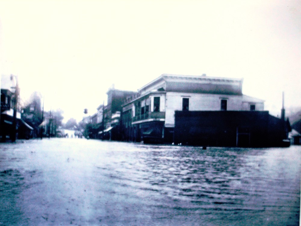
One of many floods in downtown Oakland prior to the construction of the dams by the Soil Conservation Service. July 1938. Click to enlarge photo.
Copyright USDA Soil Conservation Service. All rights reserved.
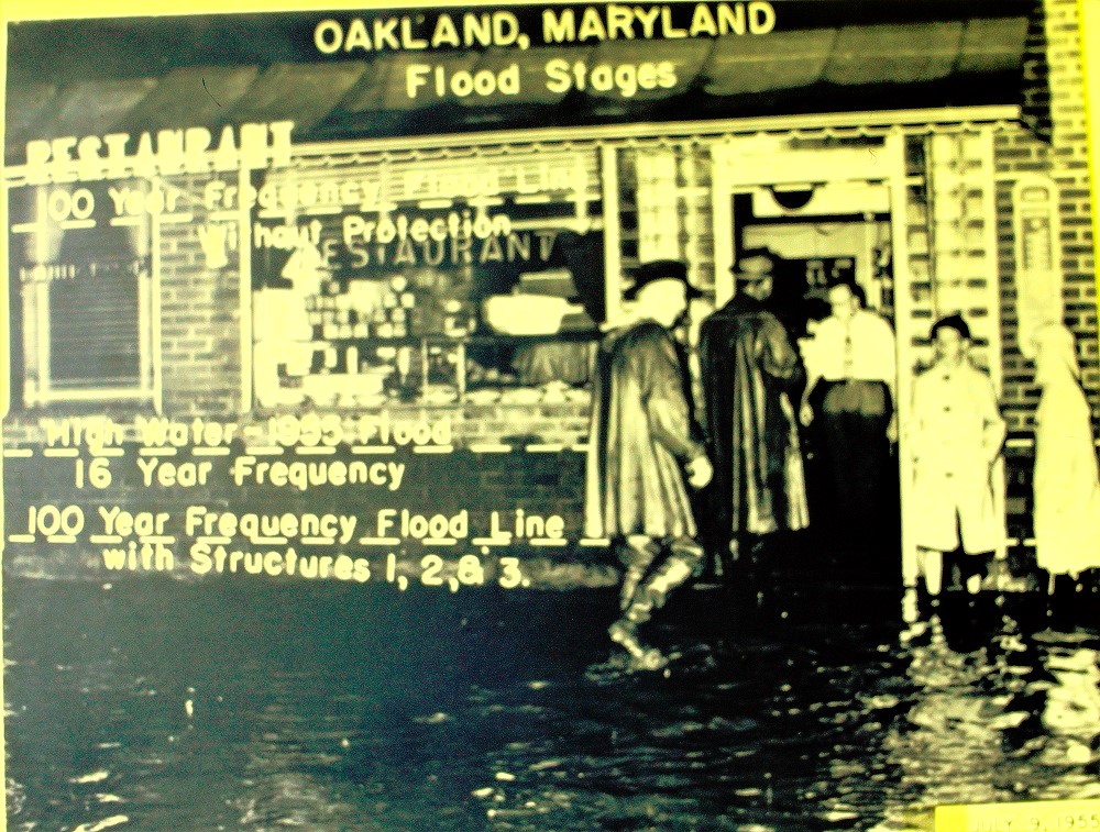
Hinebaugh’s Restaurant, July 9, 1955. Flooding like this occurred in Oakland every year before the dams were constructed. Every 16 years there was a huge flood that brought the water levels up to the windows. About every 100 years, stores were submerged to their roofs. Refer to the markings in the photo. Click to enlarge.
Copyright USDA Soil Conservation Service. All rights reserved.
Flood waters inside Smouse’s Grocery on Second Street in Oakland, July 9, 1961. It should be noted that the water level had dropped several feet before the photo was taken. Flooding was the result of high waters from Wilson Run due to a storm. Photo by Sam Moore. Click to enlarge photo.
Copyright USDA Soil Conservation Service. All rights reserved.
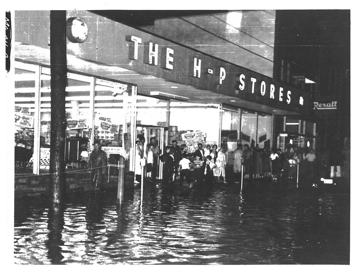
July 9, 1955. Flooding in downtown Oakland, Maryland, on 2nd Street. Towns people gather in front of the HP store to watch the flooding. Flood level was originally higher. Waters had receded 2 feet before this photo was taken. Photo by Sam Moore.
Copyright USDA Soil Conservation Service. All rights reserved.
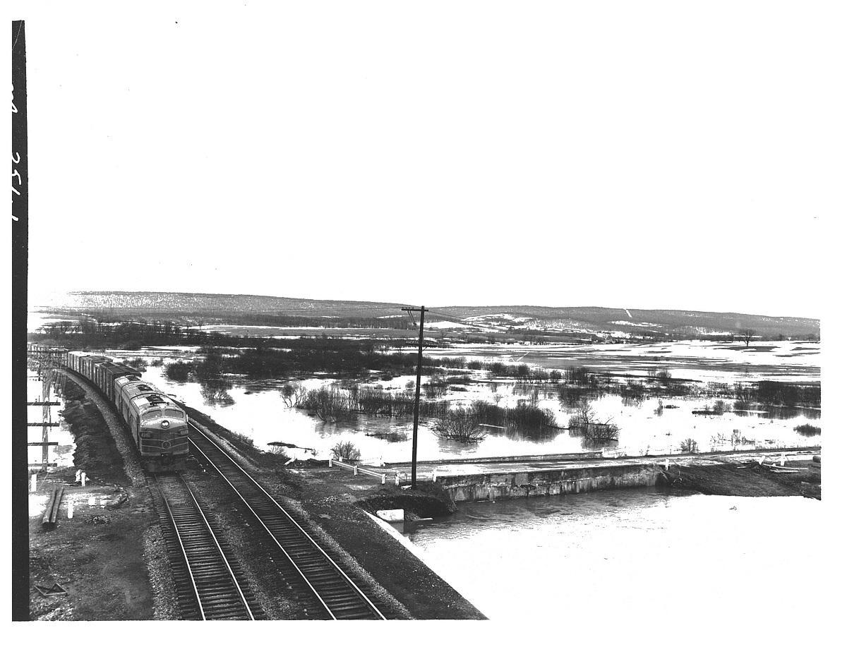
March 30, 1960. Flooding in the Weber Road Area of Oakland, Maryland. It is the area around Yough Glades Elementary School. Photo is taken from what they called “The New 219 Bridge” in 1960. High water is due to snow melt, with no rain. Photo by Nace.
Copyright USDA Soil Conservation Service. All rights reserved.
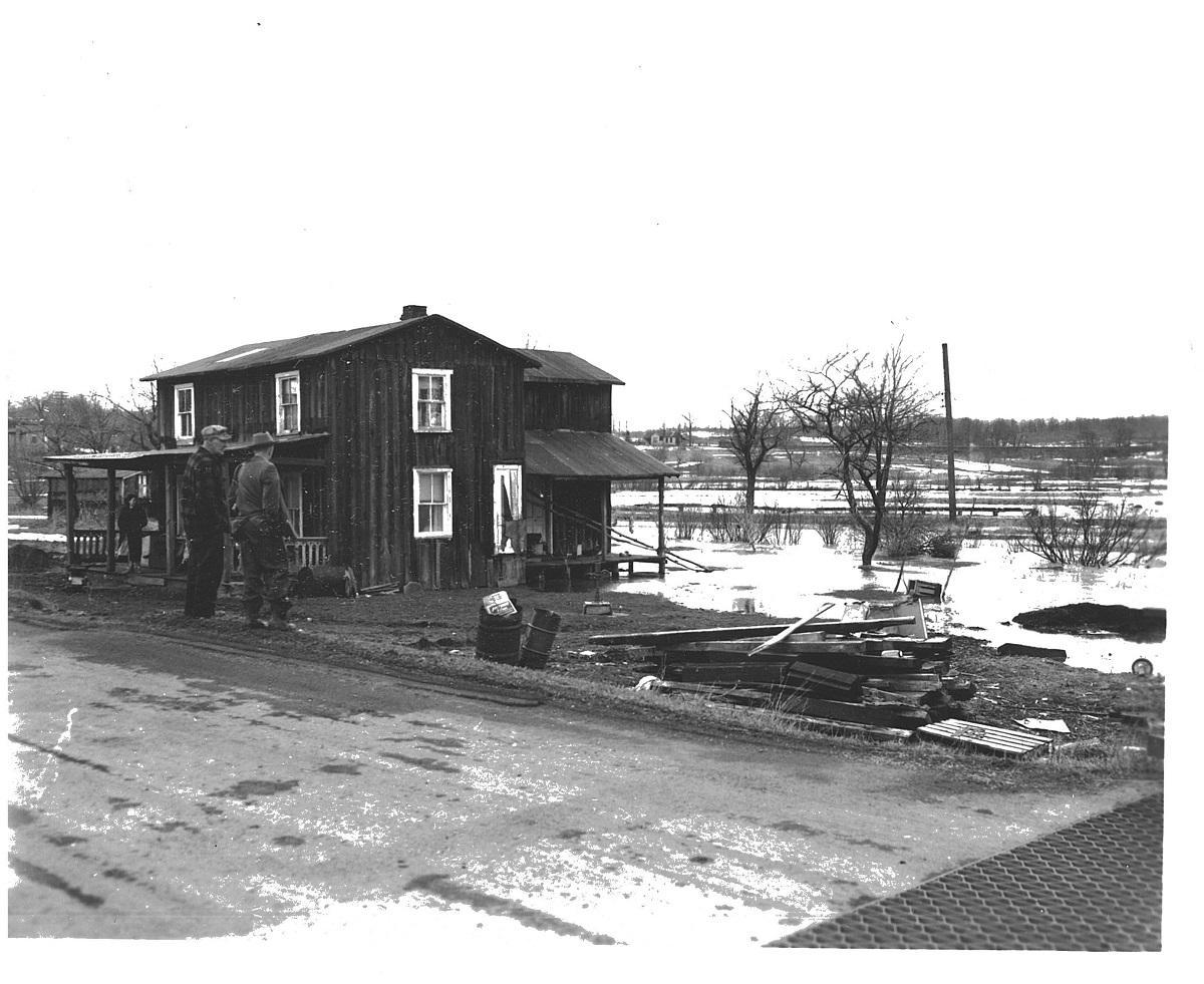
Flood waters came clear to the back door of this house, covering the back porch before receding.
Copyright USDA Soil Conservation Service. All rights reserved.
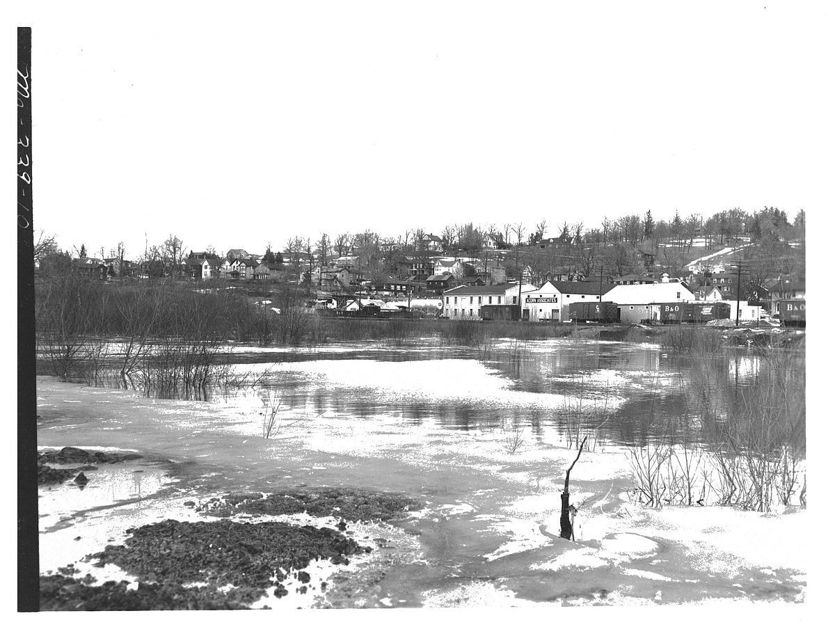
Flooding in Oakland, Maryland, from heavy runoff due to ice melt. March 30, 1960. This is strictly from ice melt. Rain did not contribute to the flooding. This is looking downstream from the bridge on South 3rd Street in Oakland. Photo by David Nace.
Copyright USDA Soil Conservation Service. All rights reserved.
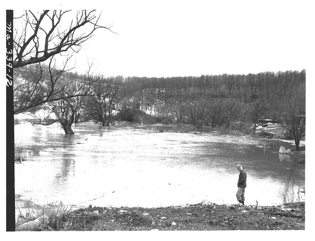
March 30, 1960. Junction of Wilson Run and the Little Youghiogheny River. The junction is underwater. Wilson Run is coming from the right foreground. This is located in downtown Oakland in the vicinity of where the Oakland Town Parking lot is now located. This flooding was caused by snow run-off alone from a spring thaw. It was specifically noted that it had not rained prior to, or during, the flooding. Can you imagine how high it would be if it did? Photo by David Nace.
Copyright USDA Soil Conservation Service. All rights reserved.