A Soil Survey Map allows landowners to see what types of soils are on their property. Soil types heavily determine the uses of land, particularly agricultural land. Some soil types are good for growing crops, and others severely restrict how well crops will grow even when making amendments to the soil.
For this reason, farmers need to be aware of what makes up the layers of soil beneath the surface in different areas of their farm.
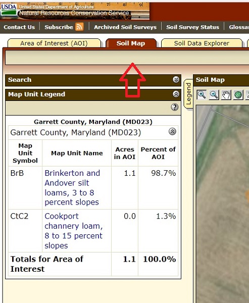
USDA'S Web Soil Survey Tool
Click image to enlarge
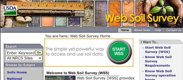
Landowners can find this information by going to the USDA’s Web Soil Survey tool. You can reach the tool by clicking on the button at the bottom of the page.
But before you go, we’ll give you some directions about how to use the tool, because it can be a little confusing at first.
Click on the button below to reach the Web Soil Survey tool.
Once there, click the big green button found in the center top of the site, which says “Start WSS”.
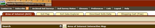
You will see some tabs near the top that look like File Folder Tabs. Make sure you are on the tab that says “Area of Interest”.
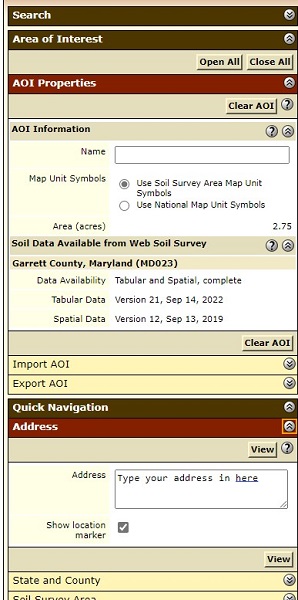
There will be a list of items on the left-hand side. Go down to “Quick Navigation” and click on the double arrows in the circle to the right of it.
A red rectangle will come up that says “Address”. Type in your address and hit the button “view”.
Once You Pull Up the Address
This next part is a little difficult at first, but if you are having trouble, practice a few times.
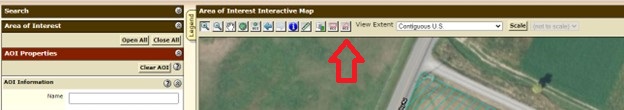
There will be some tiny little square buttons on a bar above the map. All the way on the right end of the buttons (before you reach “View Extent) there will be a loosely formed rectangle button that says AOI. Click that button.
7. This will allow you to draw the area on the map that you want to view. Click at a starting point on the map and continue to click in each point where there is a change in direction, even a slight change. Continue until you have an enclosed area.
(If you feel like you just can’t seem to get the hang of this tool, use the rectangle tool next to it. It may be harder than expected to select an area with the rectangle tool, but wherever the soil changes, you will see a different code, so selecting part of your neighbor’s property really won’t hurt your search.)
Finding the Soil Map
1. Once you have outlined the area you want to select, STOP. Don’t move the tool. Just double click and it will select the area. If you accidently drag the tool and it makes these long lines all over the map, just go to the little button on the left-hand column under “AOI Properties” that says “Clear AOI” and click on it. Then, you can start again.
2. Once the area is selected, go up to the folder tabs again, and select “Soil Map”.
3. A Map Unit Legend will come up on the left-hand column. And, you will notice that different parts of the selected area on the map to the right will have some letters in them.
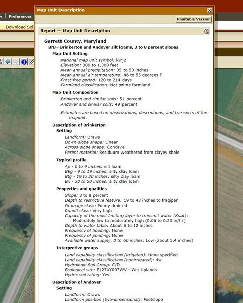
4. In the Map Unit Legend, click on one of the soil types on your property. It will bring up a “Map Unit Description”. This will tell you all about the soil in that area.
Map Unit Description
There is a lot of information contained in the “Map Unit Description” and you should take note of all of it. But here are a few items that are of particular interest.
Map Unit Setting – 1st paragraph, bottom of paragraph, look at the “Farmland Classification”.
Typical Profile – Will tell you what the layers of soil hold underneath your topsoil.
Interpretive Groups – Land Capacity Classification – This classification tells you if the land is suitable for agriculture and if there are risks to growing on this land such as heavy erosion, flooding, extreme rockiness, and more. You will need to consult another source for the codes. Click on the button to the right for a list of the codes.
Properties and Qualities – Tells things like how well the soil drains, slope, depth of the water table, whether the land is prone to flooding, and more.
To search another property, the simplest thing to do is to just pull the Web Soil Survey tool up again. It isn’t very good and being reset.
We also have some Garrett County Web Soil Survey books from the 1950’s available free of charge at the Garrett Soil Conservation District office. The office is located at 1916 Maryland Hwy, Ste. C, Mt. Lake Park, MD 21550. This is a great way to see what your farm looked like in the 1950’s.