1950's and 1960'S Aerial Photos Garrett County, Maryland
Click photo to enlarge
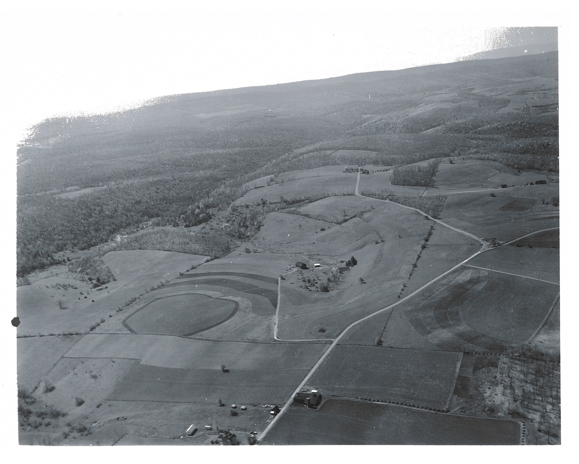
Photo taken on May 17, 1961, by Gordon S. Smith.
This aerial photo of the community of Accident, Maryland, shows 16 conservation farms including 5 farm ponds and a community fish pond at the upper edge of the village.
There are 540 acres of contour strips, 7300 feet of diversion and 40 acres of tree plantings.
Farms are equally divided between livestock and dairy.
Copyright USDA Soil Conservation Service Photo. All rights reserved.
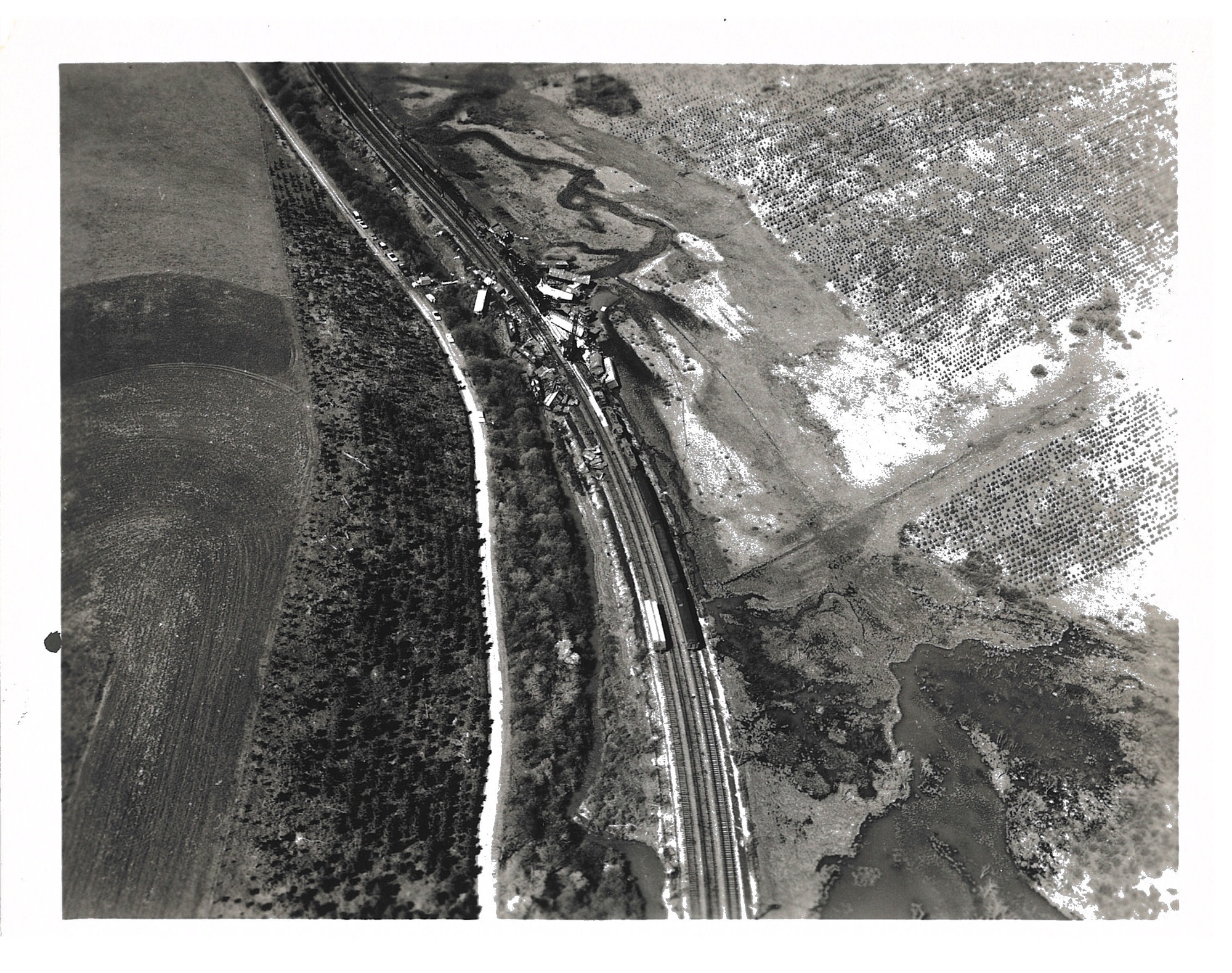
Photo taken August 2, 1955.
Four miles of Accident, Maryland.
Photo by Branstead.
Copyright USDA Soil Conservation Service Photo. All rights reserved.
Click Photo to Enlarge
1960 Garrett County, Maryland. Click photo to enlarge.
Tree plantings near the rail road tracks. Click to enlarge photo.
Click Photo to Enlarge
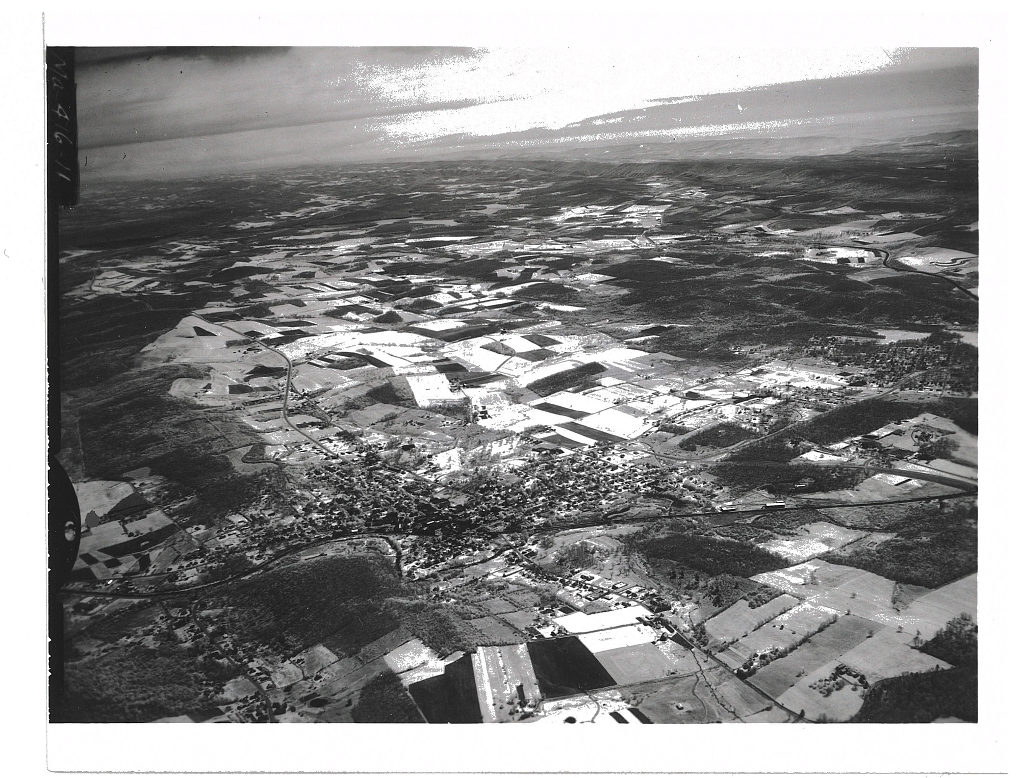
Photo was taken on May 18, 1961 by Gordon S. Smith.
The location is the Little Youghiogheny Watershed in Oakland, Maryland.
The Little Youghiogheny Watershed covers most of the land behind the town. It drains 26,275 acres of area. One of the reservoirs (#2) can be seen beyond Oakland at the left of the photo.
Copyright USDA Soil Conservation Service Photo. All rights reserved.
Photo taken May 18, 1966 by Gordon S. Smith.
The location is Jennings, Garrett County, Maryland at the Upper Casselman River Watershed.
The Firebrick plant at Jennings can be seen in the foreground in addition to a general view of the Casselman Valley.
Copyright USDA Soil Conservation Service Photo. All rights reserved.